산복도로 — The Road That Runs Above the City

t was built for people who had nowhere else to live. Now it has one of the best views in Busan.


Draw a horizontal line above Busan’s port area, somewhere between the flat land of the reclaimed waterfront and the steeper slopes of the mountains rising behind it. That imaginary line runs through what is actually a road — or rather, a series of connected roads — that trace the mid-slope of the hills above central Busan, winding through neighborhoods that were built by people who arrived with nothing and had nowhere else to go.
This is Sanbok Road: 산복도로, literally “mountain abdomen road,” named for where it sits on the geography of the hills. It does not appear in many international travel guides. It is not organized around a single attraction. It does not have a neat beginning and end. What it has is context — layers of it, accumulated across several decades of a city growing faster than any planned structure could contain.
How the Road Came to Be

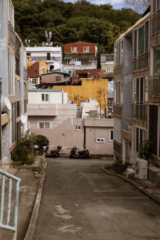
The story of Sanbok Road begins with the Korean War. When Busan became the last major city not under North Korean control in 1950 and 1951, the population swelled with refugees from across the peninsula. People needed somewhere to live, and the available flat land near the port filled quickly. What remained was the hillside — steep, difficult, without infrastructure, but available.
Refugees built on the slopes in the way that people build when the alternative is not building at all: with whatever materials could be found, in whatever configuration the terrain allowed. Corrugated metal, salvaged wood, stones for foundations. Houses arranged not according to any plan but according to the logic of the gradient — each built where the last had not yet been, climbing upward because upward was the direction in which space remained.
The road was built to serve these communities — to make the hillside neighborhoods accessible for basic services, supplies, and the movement of people between the slopes and the city below. It was functional infrastructure before it was anything else: a road for people who had no other road. As the postwar decades passed and the temporary settlements became permanent neighborhoods, the road became part of the permanent fabric of the city’s mid-slope communities.
The houses were rebuilt over time from metal and wood into brick, and from brick into concrete. The alleys were formalized. The communities acquired schools, small markets, community spaces. What had been emergency construction became settled life, and settled life accumulated the kind of texture — the particular arrangement of a neighborhood’s spaces, the specific quality of its light at particular hours, the relationship between buildings that develops only through unplanned growth — that planned developments do not produce.
What You Find on the Road

When you ride the bus routes that follow the Sanbok Road — or walk sections of it on foot, which is a slower and more immediate experience — the city resolves into something that its coastal and commercial areas do not show.
The view is the first thing. From the road, the harbor is visible below in a way that makes the relationship between the city and the water clear rather than incidental. The port infrastructure — the container terminals, the bridges, the industrial waterfront — is laid out in a comprehensible way. The older residential areas descend in stages toward the flat land. The mountains continue above. You are in the middle of the geography rather than at its edge.
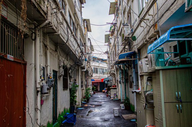
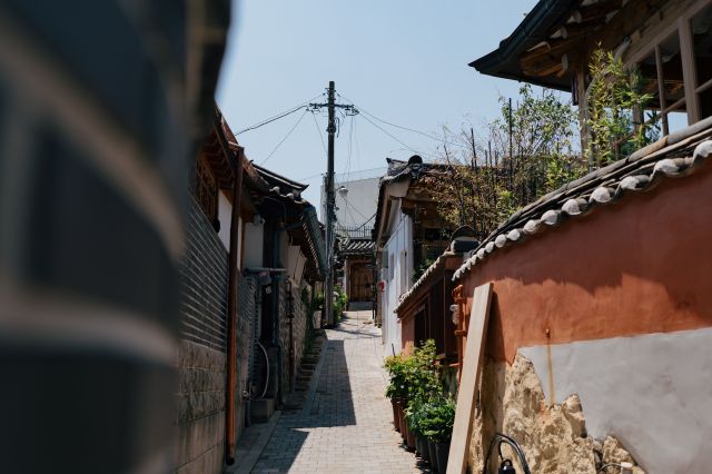
The neighborhoods that line the road have the character of communities that developed without consistent planning oversight: narrow alleys that branch off the main road and descend between tightly packed houses, small convenience stores and neighborhood restaurants that serve the people who live here rather than visitors passing through, walls with murals painted by community art projects that came and went. Some of the murals are good. Some are faded. The distinction matters less than the fact that the walls have been painted at all, which means people cared enough about the appearance of these alleys to do something about them.
The population along the road has aged as younger residents have moved to newer apartments in other parts of the city. The elderly residents who remain are the long-term inhabitants of communities that grew from wartime necessity into something with its own identity — people who have watched the city change below them for decades without the view from their windows ever disappearing.
The Circular Bus Route

One of the more useful pieces of local knowledge about Sanbok Road is the existence of bus routes specifically designed to follow it — circular routes that loop around the hillside neighborhoods and provide what amounts to a moving viewpoint tour of the mid-slope communities and their views over the city.
These routes exist primarily for the residents of the hillside neighborhoods, not for tourists. The buses run on schedules determined by the needs of people going to and from work, school, and the market. They do not narrate what you are seeing or stop at designated viewpoints. You simply sit on a bus as it follows a road that was built for people who had nowhere else to go, and the city is below you, and the view is as good as you will find anywhere in Busan.

A Different Kind of Busan

There is a version of Busan that is organized around the sea — the beaches, the harbor, the marine cable car, the view of the bridge at night. That version is real and significant and worth experiencing.
Sanbok Road represents a different axis: not the relationship between the city and the water, but the relationship between the city and the hills behind it. The road runs above the place where the city started, through communities that existed before Haeundae was developed, before the high-rise hotels arrived, before the city began marketing its coastal character to the world.
The people who built these neighborhoods on a steep hillside during and after a war did not think they were creating something interesting for later visitors to discover. They were solving an immediate problem. What they left behind is a different kind of interesting from what you plan and design: the specific texture of a community that grew because it had to, in the specific form that the terrain and the circumstances allowed.
The view over the port from mid-slope on a clear morning is one of the better views available in a city full of good views. Getting there requires going somewhere that does not appear on the standard route. That, in this context, is part of the point.

롯데 자이언츠 — Baseball Is Busan’s Other Religion

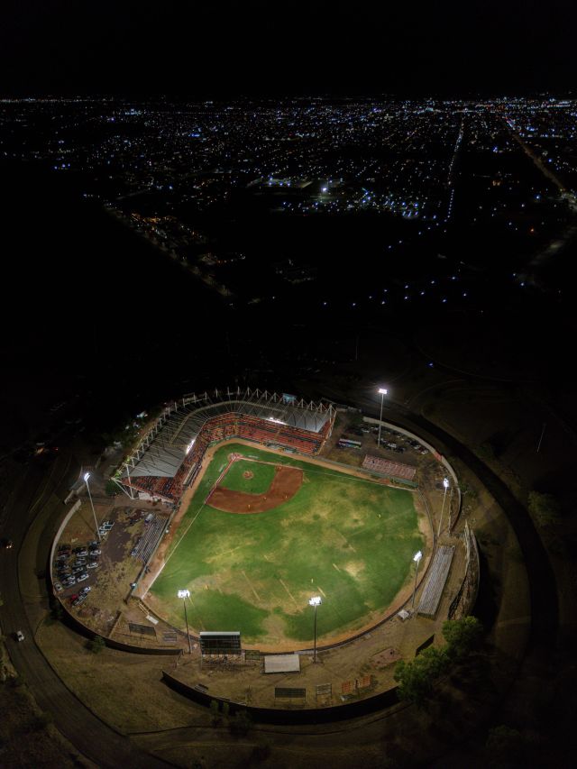
he team has not won a championship since 1992. The stadium is full anyway.


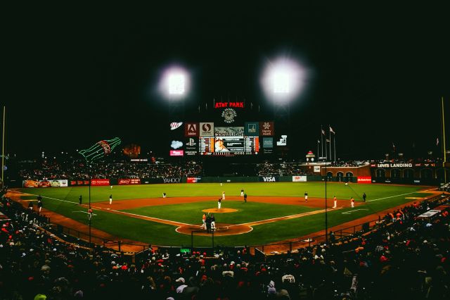
There are cities where sport is something people follow, and there are cities where sport is something people belong to. Busan is the second kind of city, and the Lotte Giants are the team that explains it.
The Lotte Giants have won the Korean Series twice — in 1984 and in 1992. Those are the only titles in the franchise’s history. A considerable portion of the fan base that fills Sajik Baseball Stadium on summer evenings was not yet born when the second championship was won. None of this has materially reduced the fervor with which Busan follows its team. If anything, the long drought since 1992 has become part of the identity — something endured together, a shared condition that makes the belonging feel more rather than less real.

The Team and Where It Came From

The Lotte Giants were founded on May 6, 1975, by Lotte Confectionery — now part of the broader Lotte Corporation — as an amateur baseball team based in Seoul. The team became professional when the Korea Baseball Organization league launched in 1982 and relocated to Busan, where it has been based ever since.
The Giants made their KBO League debut on March 28, 1982, at Gudeok Baseball Stadium, defeating the Haitai Tigers 14–2. The result was encouraging; the season was less so, with the team finishing fifth out of six. The trajectory improved rapidly. In 1984 — their third professional season — the Giants won the Korean Series, defeating the Samsung Lions four games to three. Their ace pitcher Choi Dong-won was one of the most dominant players in Korean baseball that season, and the championship cemented the team’s relationship with a city that had adopted it with characteristic intensity.
The second championship came in 1992. The Giants have reached the Korean Series multiple times since, without converting those appearances into titles. The wait has now extended more than three decades, which is long enough that the anticipation itself has become a permanent feature of the team’s cultural texture.
The team moved to Sajik Baseball Stadium — located in Dongnae-gu, north of the city center — when the new stadium opened in 1986. It remains their home ground.

부산 갈매기 — The Busan Seagulls

The Lotte Giants’ most defining feature is not their record but their atmosphere, and the atmosphere is inseparable from a song.
“부산 갈매기” — Busan Seagulls — is a folk-inflected song written by Moon Seung-jae that became the team’s anthem and is now so associated with the Giants that it functions as something closer to a city song. The seagull is the official bird of Busan. The song is about the sea, and migration, and belonging to a specific coast. It is sung by the crowd at Sajik with the kind of volume and unison that makes a stadium feel like a single entity rather than a collection of individuals.
The seagull has migrated outward from the stadium as well. “부산 갈매기” is what people from Busan sing when they are away from the city and missing it. It is what gets played at reunions and gatherings. The team gave the city its most recognizable popular song, and the city gave the team its identity. The exchange has been running for more than forty years.

A Night at Sajik

There are experiences in Busan that are on every travel list, and there are experiences that are not on any list but that provide something the listed ones cannot. A Lotte Giants home game at Sajik on a summer evening is the second kind.
The logistics are simple. Take the subway to Sajik Station, walk to the stadium, buy a ticket. Tickets are available at the gate for most regular-season games — the Giants draw well, but except for derbies and marquee matchups, walk-up access is generally possible. Beer and fried chicken are available at the stadium concessions, and the combination of the two in this particular setting has a specific cultural weight that anyone familiar with chimaek culture will immediately understand.
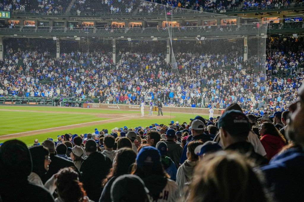
What the stadium offers that a beach or a market cannot is collective emotion in real time. The fans at Sajik are participatory in the way that Busan people are participatory in things they care about: loudly, directly, without much reserve. Specific cheers accompany each batter by name, each team having its own chant that the crowd executes with practiced precision. The Lotte fans have developed a reputation across the KBO for the quality and volume of their support, which is related to the fact that Busan has had a single team to concentrate its loyalties on for more than forty years.
The Giants’ record in any given season varies. The experience at the stadium does not vary much. The crowd comes prepared to be invested.

The Drought and What It Means

The last Korean Series championship in 1992 is a fixed point in Busan’s sports consciousness in a way that titles rarely function. It is not that older fans don’t remember — many do, and the anniversary of the win is noted with the kind of specificity that suggests a date carved rather than remembered. It is that the gap is long enough to have shaped what following the Giants means to an entire generation.
Busan has a word for this feeling in a more general context — it is not specific to baseball — but the condition of loving something that perpetually disappoints without ever stopping is both very specific and very recognizable. The Giants provide it in concentrated, seasonal form.
In 2009, the team set a KBO record that still stands: 1.38 million spectators in a single season, the highest attendance ever recorded for any South Korean sports league in one year. The team did not win the championship that year either. The record stands on its own terms, unattached to a title, as a measurement of something other than victory.

What Baseball Means in Busan

Most cities with sports teams have a degree of civic pride attached to those teams. What Busan has with the Giants is something more structural than that — the team arrived in 1982 and immediately became the singular focus of what is, by any measure, a city with a strong appetite for collective loyalty.
Seoul has multiple teams, which dilutes the connection. Busan has one. When the Giants play, Busan pays attention in the way that undivided attention works. The team’s blue and red colors appear in contexts that have nothing to do with baseball. The seagull appears on merchandise and murals and the kind of casual city signage that marks a symbol as genuinely absorbed rather than manufactured. Fans who moved to Seoul for work still check the scores.
Whether or not the Giants win the next Korean Series will change something. Thirty-four years is long enough for a championship to mean something more than a title. It will mean resolution — and Busan, which has been waiting with the particular patience of people who have nowhere else to put their loyalty, will know what to do with it when it arrives.

해동용궁사 — The Temple That Chose the Sea Instead of the Mountain

Every Buddhist temple in Korea is built in the mountains. Except this one.


There is a general principle in Korean Buddhist architecture: temples belong in the mountains. This is not arbitrary. The mountains provided physical separation from the political turbulence of court life, practical protection during periods of persecution, and a natural environment that Buddhist thought has long associated with clarity and spiritual withdrawal. Nearly every significant temple in Korea — Tongdosa, Haeinsa, Seonamsa, Beomeosa — sits in a forested valley or along a mountain slope, with the city at some remove below.
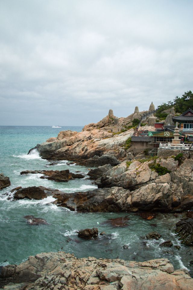
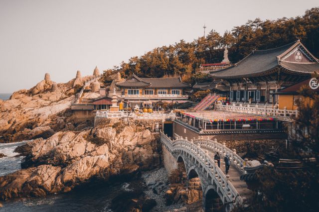
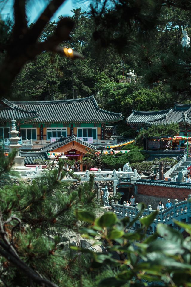
Haedong Yonggungsa breaks this principle completely. It sits not in the mountains but directly on the northeastern coast of Busan, in what is now Gijang-gun, on a promontory of exposed rock where the sea arrives from three directions and the sound of waves is continuous inside the temple grounds. There is no forested approach, no gradual withdrawal from the world. You descend 108 stone steps and arrive, almost without transition, at a complex of shrines and statues arranged across the rocks, with the East Sea spread out behind them.
It is, by any measure, an unusual place to put a temple. The story of why it is there is both historical and legendary — and the two accounts are worth keeping separate.

The Foundation and Its Destruction

The historical record is clear about the date: Haedong Yonggungsa was founded in 1376, during the Goryeo Dynasty, by the monk Naong Hyegeun — a figure of considerable importance in Korean Buddhist history who served as an advisor to King Gongmin and helped lay the groundwork for Buddhist practice in the subsequent Joseon era. The temple was originally named Bomunsa.
The legendary account of why Naong chose this location says that the Divine Sea God of the East Sea appeared to him in a dream and instructed him to build a temple on the coastal cliffs. If he did so, the dream promised, the nation would become larger and more stable. Whether or not one takes the dream literally, the effect is the same: a temple was built on the sea, in a location that defied the convention of mountain placement.
What happened next is documented more clearly. In 1592, during the Japanese invasion known as the Imjin War, the original temple structures were burned to the ground. The temple remained in ruins for more than three hundred years — an unusually long period of abandonment, even in a country whose sacred sites have repeatedly been damaged by conflict and subsequently rebuilt.
Reconstruction began in the early 1930s, when the monk Ungang of Tongdosa Temple restored the complex. The name was also changed during this period: from Bomunsa to Haedong Yonggungsa — 海東龍宮寺, which translates roughly as the Dragon Palace Temple of the Eastern Sea. The name reflects the temple’s dedication to the Goddess of Mercy, who in Korean Buddhist tradition is believed to reside in the sea. The temple’s current name was formally designated in 1974.

What the Complex Looks Like

The approach to Haedong Yonggungsa begins before the temple itself is visible. From the parking area and the street-food vendors that now cluster at the entrance — a commercial layer that has developed around the temple’s tourism in recent decades — a path leads down toward the coast. The 108 steps are carved into the hillside, each step corresponding to one of the 108 earthly desires that Buddhist practice seeks to overcome.
At the bottom, the complex opens across a series of rock platforms at sea level. The main hall, Daeungjeon, faces the water directly, with the sea as its permanent backdrop rather than as an incidental view. A three-tiered stone pagoda guarded by four lion statues stands on the rocks nearby. Several smaller shrines are tucked into the cliff face or positioned at the water’s edge. The Haesu Gwaneum Daebul — a large statue of the Goddess of Mercy — faces the open sea, her gaze directed outward, away from the land.
The tide determines a great deal about what the rocks look like on any given visit. At high tide, the sea comes close enough to the lower shrine areas that the sound and spray are immediate. At low tide, the exposed rock formations extend the available space and change the character of the site. The temple does not behave like a fixed architectural space; it responds to conditions.
There is also a cave shrine accessible at certain tide levels, dedicated to the Dragon King — a figure from Korean shamanistic tradition that the temple has incorporated alongside its Buddhist iconography, reflecting the long-standing integration of Buddhist and indigenous Korean religious practice that characterizes many Korean sacred sites.

The Practical Reality

Haedong Yonggungsa is genuinely crowded on weekends and holidays, and the crowds are worth planning around if you care about experiencing the place as anything other than a logistical challenge. The 108 steps become a slow-moving queue in peak conditions. The rock platforms fill with visitors taking photographs. The vendors at the entrance and the temple’s well-developed commercial infrastructure can make the approach feel less sacred than the guidebooks suggest.
Early morning is the correct answer. The temple is open from 4 AM, and the walk down the 108 steps in the hour after dawn — with the sea mist still on the water and the shrine area largely empty — produces a different experience from anything available at midday on a summer Saturday. The distance from central Busan is a factor, but the bus connections from the Haeundae area are manageable.
The temple’s location in Gijang-gun, the northeastern district of Busan beyond Haeundae, puts it at some distance from the main cluster of the city’s attractions. This distance is one of the reasons it remains less overwhelmed than it might otherwise be. Getting there requires a specific intention rather than falling naturally into a standard itinerary.

What Makes It Worth Going

What Haedong Yonggungsa offers is not primarily architectural complexity or historical depth — its current buildings are relatively recent, and the history involves centuries of ruins. What it offers is a spatial experience that genuinely has no equivalent among Korean sacred sites.
The combination of religious architecture with the immediate physical presence of the sea is unusual enough to stop you in the way that things which violate your expectations can stop you. You expect mountains. You find the ocean. You expect quiet withdrawal from the world. You find waves arriving directly at the shrine wall. The dissonance produces an attention that a more conventional temple might not.
The monk who had a dream in 1376 about building a temple on the sea did not explain himself clearly. But the place that resulted from that decision is, whatever else you make of it, unlike anything else in Busan or in Korea.

해운대 — What Busan’s Most Famous Beach Looks Like When You Live Here

Ten million visitors every summer. And the people who actually live here go somewhere else.

Haeundae Beach is 1.46 kilometers long and about 40 meters wide at most. That is not a large piece of land. Yet in summer — specifically in the weeks between late July and mid-August — that stretch of sand accommodates up to 120,000 people on a single day. The umbrellas go up before sunrise. By midmorning there is no visible sand between them.
Photographs of this scene have circulated so widely that Haeundae has become Korea’s most recognizable image of summer. The wall of high-rise hotels behind the beach. The dense crowd at the water’s edge. The way the whole thing looks, from above, like a city that decided to move temporarily to the shore.
If you live in Busan, you have seen this image so many times that it no longer looks like a place you would visit. You know it looks like that. That is the problem.

The Name and Where It Came From

The name Haeundae — 해운대 — does not refer to the beach itself. It was the pen name of Choi Chi-won, a scholar and poet of the late Silla Kingdom who lived from 857 CE into the early tenth century. He is said to have traveled through this stretch of coastline, found it beautiful enough to carve his pen name into a rock on what is now Dongbaek Island, and left. The landscape kept the name.
For most of Korean history after that, the area remained a small fishing settlement. It was not particularly accessible or well known. Japanese visitors began using it as a seaside resort after Busan’s port opened in 1876, drawn by both the beach and the hot springs that still flow nearby. The beach became more widely accessible to Korean visitors when a railway line opened through the area in 1934. The US military used the beachfront during the postwar occupation period, and it was not officially opened to the Korean public until 1965.
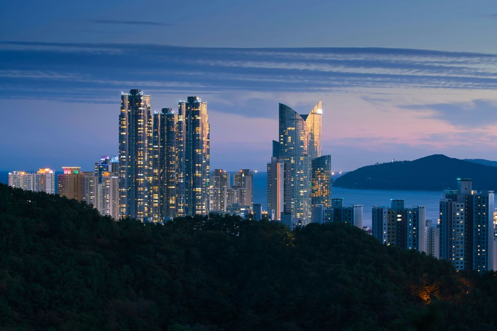
In less than a generation after that opening, Haeundae transformed completely. By the 1990s, the pine forests behind the sand had been replaced by hotels. Marine City, the cluster of luxury residential towers that now frames the western end of the beach, rose from what had been open land. The skyline that visitors photograph today was built almost entirely within living memory.

What Visitors Come For

The beach is genuinely beautiful outside of peak season. In spring and autumn, the sand is wide and pale, the water is visible from one end of the bay to the other, and the crowd is manageable. The cafes along Dalmaji-gil, the curved hillside road overlooking the beach from the east, fill with people who have walked up from the shore to sit with a coffee and look at the sea. In winter, the beach empties almost completely, and the Polar Bear Festival — held every January since 1988 — draws a few thousand people who swim in the near-freezing water anyway, for reasons that vary from personal challenge to a kind of public theater.
Near the western end of the beach, Dongbaek Island sits connected to the mainland by a walkway that was once open water. The island is forested with camellia trees and has a coastal trail that circles its edge, passing through shade and emerging at points that open directly onto the sea. At the island’s edge, the Nurimaru APEC House — built in traditional Korean architectural style for the 2005 APEC Summit — is open to visitors and offers one of the cleaner views of both Marine City and the wider curve of the bay.
The hot springs are real, and accessible at a public footbath near the beach’s tourist information center, free of charge. The Haeundae Traditional Market, a few streets back from the shore, sells gukbap — a rice and soup dish that has been a Busan breakfast staple for decades — at prices that have not kept up with the neighborhood around them.

What the Beach Looks Like to Locals

The thing about Haeundae is that its reputation has become its defining characteristic. Everyone knows it is famous. Everyone knows it will be crowded. And this knowledge, repeated often enough, becomes the thing itself.
Ask someone who grew up in Busan where they go to swim in summer, and you will rarely hear Haeundae as the first answer. You will hear Songjeong Beach, a smaller, rockier cove a few kilometers northeast that local families have been visiting for generations, where the water is cleaner and there is still some possibility of finding a patch of sand to sit on. You will hear Ilgwang, further along the coast, which requires more effort to reach and is quieter for it. You might hear Dadaepo, at the opposite end of Busan, where the wide tidal flats extend at low tide and the sunsets arrive without the backdrop of skyscrapers.
Haeundae is not avoided — that would be overstating it. People from Busan walk its promenade at night when the crowd has thinned and the Marine City lights are reflected in the water. They eat at the restaurants nearby. They bring visiting relatives to see what all the photographs are about. They watch the beach’s annual fireworks display from a distance, because standing inside the crowd has never appealed.
But the beach that fills every international travel guide and every summer news broadcast about Korea — the beach with 10 million annual visitors, the beach you can recognize from a photograph from almost anywhere in the world — is not the beach that the city itself treats as its own. That particular tension, between a place’s global reputation and its local reality, is something Haeundae carries unusually visibly.

The View from Outside the Frame

There is a photograph that gets taken at Haeundae more than any other. It is taken from somewhere elevated — from a hotel window, or from one of the higher points on Dalmaji-gil — looking down at the beach in peak summer. The sand is invisible beneath the umbrellas. The towers rise behind it. The sea, beyond the crowd, is open and blue.
This photograph is accurate. It is exactly what Haeundae looks like in late July.
What it does not show is the same beach in October, when the umbrellas are gone and the sand is back and the sea turns a deeper, greener shade. It does not show the early mornings when people jog the promenade before anything is open. It does not show the winter light on the water, or the way the camellia trees on Dongbaek Island flower in a season when most people have forgotten the beach exists.
The famous image of Haeundae is real. The beach beyond that image is also real.

In a city this size, both get to exist at the same time.